
Do You Like the Preferred Concepts for Burlington’s GO Mobility Hubs?
Published December 7, 2017 at 5:03 pm
Preferred concepts for the new, complete neighbourhoods being built around three GO Transit stations in Burlington have been released by city staff.
Preferred concepts for the new, complete neighbourhoods being built around three GO Transit stations in Burlington have been released by city staff.
The report was received at a Dec. 4 planning and development committee meeting – for community and council feedback and discussion – in relation to the Aldershot, Appleby, and Burlington GO station mobility hubs.
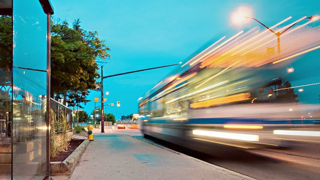
A mobility hub is a location with several transportation options and a concentrated point for a mix of uses such as transit, employment, housing, recreation and shopping.
Mobility hubs will be neighbourhoods that are environmentally friendly, infrastructure-efficient, walkable, bikeable and transit-oriented.
Videos


In Burlington, the mobility hubs will be planned and developed near the Aldershot, Burlington and Appleby GO stations as well as in the downtown.

Map courtesy of the City of Burlington
Public consultations were held over the summer.
Here are the recommendations:
Aldershot GO Mobility Hub
The existing area around the Aldershot GO mobility hub is comprised of several established residential areas adjacent to the boundary and includes the presence of existing low-intensity and land intensive employment uses.
There’s strong community support for revitalizing Plains Rd. into an attractive, mid-rise main street. Within the Aldershot GO Mobility Hub, the following were identified as additional unique considerations for this area:
– Recognizing the need to vary the maximum heights for new mid-rise development within the hub in order to achieve sensitive transitions to established residential neighbourhood areas outside of the hub.
– Concentrating higher intensity development on large brownfield/greyfield sites that contain existing employment uses in order to encourage mixed use development.
– Recognizing the existing employment function in the area and planning for future employment and commercial uses in the hub.
– Planning for flexible commercial and retail spaces that can respond to the changing commercial / retail landscape.
– Creating new streets and active transportation connections to enhance the existing transportation network, including the establishment of new east-west corridors which will improve permeability through the area for pedestrians and cyclists and mitigate traffic associated with future growth.
– Focusing height away from Plains Rd. and towards the rail corridor to concentrate future residents in close proximity to the GO station and to maintain the mid-rise vision for Plains Rd.
Burlington GO Mobility Hub
The existing area around the Burlington GO Mobility Hub is comprised of large parcels in areas heavily fragmented by rail/spur lines, grade separated overpasses and underpasses and wide arterial city and regional streets.
The study area doesn’t contain any existing residential uses (with the exception of the tall residential Paradigm development under construction) and lacks any functional parks or open spaces.
Most of the properties currently contain large-scale and/or auto-centric commercial uses as well as heavy employment uses both within and adjacent to the study area.
Within the Burlington GO Mobility Hub, the following were identified as additional unique considerations for this area:
– Limiting intensity in areas within close proximity to existing industrial uses which continue to have a planned employment function.
– Locating the highest intensity developments in locations that will support strong active transportation and frequent transit corridor connections as well as provide new uses and amenities that will support the planned functions of both the Urban Growth Centre/Downtown mobility hub and the Burlington GO mobility hub.
– Planning for a potential future Provincial Inter-Urban Transitway through the area that connects to the Burlington GO Station, subject to further discussion with the Province regarding proposed amendments to the Parkway Belt West Plan.
Appleby GO Mobility Hub
The existing Appleby GO Mobility Hub is largely comprised of existing employment uses north of the rail line including offices, manufacturing and industrial uses.
The area south of the rail line is characterized by low and mid-rise residential development south of Fairview St. as well as large employment lands along Fairview, some of which are vacant or undeveloped in the area around the Appleby and Fairview intersection.
The area is well served by a major park (Sherwood Forest Park) and has direct access to the Centennial Multi-Use Pathway connecting the area directly to downtown.
Within the Appleby GO Mobility Hub, the following were identified as additional unique considerations for this area:
– Providing new parks and open spaces to serve employment areas and employees.
– Generally allowing for higher intensity development on employment lands to help establish the hub as a major employment destination.
– Concentrating the highest intensity employment uses in close proximity to the GO Station, Appleby Line and the QEW corridor, north of the rail corridor.
– Creating new streets and active transportation connections to enhance the existing transportation network to improve permeability for pedestrians and cyclists and mitigate traffic associated with future growth.
Staff will use the preferred concept for each mobility hub to develop the Area Specific Plan (ASP) and presentations will be made before council in the second quarter of 2018.
insauga's Editorial Standards and Policies advertising